

SURVEY & MAPPING ACTIVITIES
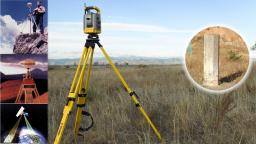
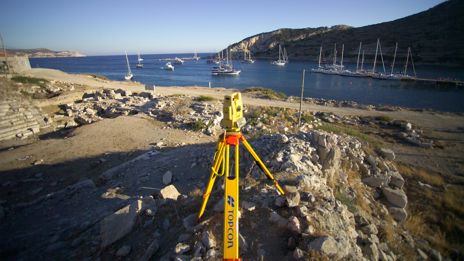
1.CONVENTIONAL METHOD
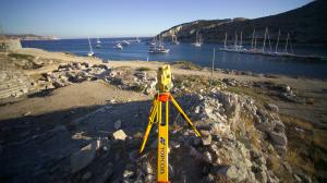
✓Establishment / Densification of Geodetic Triangulation Points with GNSS, Static GPS Observations
✓Measurements with GPS and Total Station and Network Adjustment
✓Details Measurements with Electronic Total Station, Processing of Row Data
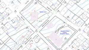
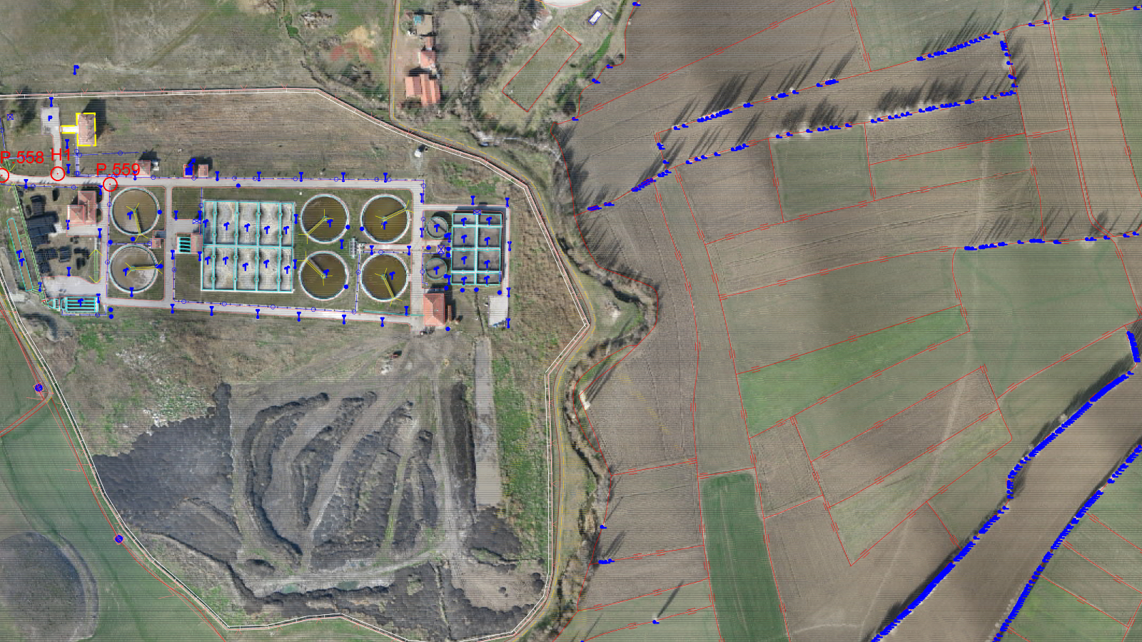
✓Creation of CAD&DTM Files with Enhanced Mapping Software
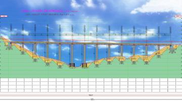
✓Producing 1:1000 & 1:5000 scale Map for Various Purposes; Urban Infrastructure Project Design and Urban Planning
✓Preparing large scale Maps for Dam & Hydro Electrical Power Plant Desing Activities (HEPP)
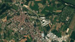
2.REMOTE SENSING IMAGE PROCESSING
To meet the special requirements of the institutions by processing and analysing the satellite images;
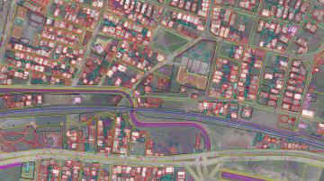
✓Creation of Image Maps in 1:50,000 – 1:2,400 Scales for Land and Urban GIS Projects by Using Sattelites Image Data
✓Creation of Digital Elevation Models (DEM) for Pre-Engineering Projects
✓Existing Situation and Contour Map for Master Urban Planning
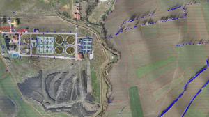
✓Supplying Geographical Data for Management of Water Resources and Water Basins
✓Supplying Geographical Data for Environmental Disaster and Crisis Management
✓Geographical and Attribute Data Supplying for Building Permitting and Taxation Works
✓Agricultural Product Applications
✓Determination of Illegal Product
✓Forest Feasibility and Management
✓Determination of Environmental Effects
✓Oil / Natural Gas Exploration Research
✓Route Definition
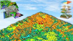
3.PHOTOGRAMMETRICAL MAPPING
✓Consultancy on the Use of Aerial Photographs and Photogrammetry
✓Planning and Implementing Flight Missions for the Capture of Vertical Aerial Photography
✓Production of Large and Small Scale Maps
✓Creation of Digital Topography, CAD Files and GIS Base Map Data-Sets
✓Production of Orthophotos and Mosaics
✓Three-Dimensional Terrain Modelling (DEM, DTM)
